Top Offline Map Apps for Travellers in Remote Areas
The signal disappears. The blue GPS dot spins aimlessly. And suddenly, what felt like an adventure turns into a guessing game—one that involves wrong turns, detours, and the creeping anxiety of not knowing where the road goes next.
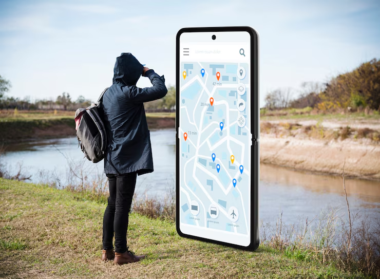
For anyone who’s ever found themselves in the middle of nowhere with no bars and no map, it’s clear: offline map apps aren’t a luxury—they’re a necessity.
When exploring remote villages in the Andes, navigating winding roads in the Balkans, or hiking across Icelandic valleys, having access to maps without internet can mean the difference between a smooth journey and a GPS meltdown.
Thankfully, the days of unfolding paper maps or relying solely on cell signal are over. Modern travel navigation tools are built for the unexpected—and they work brilliantly, even when the Wi-Fi doesn’t.
Let’s dig into the top offline map apps that deserve a permanent spot on your home screen before the next unplugged adventure.
Why Offline Maps Matter More Than Ever

Mobile connectivity has come a long way—but it still hasn’t reached everywhere. Mountains block signals. Islands go dark. And even bustling cities sometimes hide dead zones underground or in narrow alleyways.
Beyond that, international data plans can be expensive. Not everyone wants to burn through gigabytes just to find the nearest gas station or walking trail.
That’s where offline map apps shine.
They offer:
- Peace of mind in the unknown
- Freedom from roaming charges
- Reliable navigation in patchy or no-service zones
- Battery-friendly operation compared to constant streaming
But not all apps are created equal. Some excel at urban exploration. Others shine off the grid. Some are heavy on detail, while others are minimalist and fast.
Here’s a look at the best offline options for every type of remote-area traveller.
1. MAPS.ME – Fast, Compact, and Surprisingly Powerful
Let’s start with a long-time favourite. MAPS.ME has earned its place on countless travellers’ phones with a simple promise: detailed, offline maps of the entire world.
What Makes It Great:
- Entire countries or regions can be downloaded at once
- Includes hiking trails, local businesses, and attractions
- Routing for driving, cycling, and walking
- Works offline with no ads once downloaded
- Free to use
MAPS.ME is perfect for those who want lightweight, reliable directions without constant online dependency. It’s particularly helpful for backpackers and hikers, as it includes footpaths and natural landmarks often missed by other apps.
Best For: Independent travellers, hikers, budget travellers, anyone heading off the beaten path.
2. Organic Maps – Privacy-Focused and Open Source

Built by the same folks who originally developed MAPS.ME, Organic Maps is the open-source, ad-free sibling. And it has quietly become one of the best maps without internet for travellers who care about privacy and simplicity.
Standout Features:
- 100% offline functionality
- No tracking, ads, or data collection
- Hiking trails, cycling routes, and elevation contours
- Frequent community-driven updates
If the goal is to explore without giving up privacy—or without extra digital clutter—this is a top pick.
Best For: Privacy-conscious explorers, minimalist travellers, off-grid hikers.
3. OsmAnd – Built for Customisation and Detail
OsmAnd (short for OpenStreetMap Automated Navigation Directions) is a powerhouse. It’s not the flashiest app, but what it lacks in polish, it makes up for in depth.
What You’ll Love:
- Fully offline vector maps
- Turn-by-turn navigation (even offline)
- Custom map layers (elevation, slope, ski tracks, and more)
- Topographic detail for serious outdoor planning
- Supports GPX file imports
There’s a bit of a learning curve—but once dialled in, OsmAnd is a go-to tool for cyclists, mountaineers, and anyone planning complex routes in remote locations.
Best For: Outdoor enthusiasts, long-term travellers, cycle tourers, advanced navigators.
4. Gaia GPS – The Adventurer’s Toolkit
Originally built for hikers, hunters, and trail lovers, Gaia GPS is less about roads and more about wilderness.
Highlights:
- Highly detailed topo and satellite maps
- Trail overlays with difficulty ratings
- Weather layers and terrain analysis
- Tracks and records hikes in real time
- Offline mode with pre-downloaded regions
This isn’t for finding the nearest café—it’s for navigating national parks, backcountry campsites, and alpine trails.
Best For: Hikers, climbers, overlanders, wilderness trekkers.
Want to explore more language tools for your next adventure? Check out Best Translation Apps for Travellers in 2025 for a roundup of the top options for different needs, regions, and budgets.
5. HERE WeGo – Clean, Reliable, and User-Friendly
HERE WeGo doesn’t get as much press as some of the other apps on this list—but it’s been quietly powering GPS systems for major car companies for years.
Why It Works:
- Free offline maps for over 100 countries
- Public transport info (in select areas)
- Turn-by-turn driving and walking directions
- Clean interface with minimal clutter
- Voice navigation offline
It may not have every hiking trail, but for remote towns, rural roads, and small cities, it’s rock solid.
Best For: Road trippers, rural explorers, car travellers in remote zones.
6. Google Maps (with Downloaded Regions)
Yes, even Google Maps makes the list. While it’s best known for its online features, its offline capabilities have improved dramatically over the years.
The Upside:
- Familiar interface
- Download areas in advance (cities, regions, routes)
- Offline driving navigation with voice guidance
- Integration with saved lists and starred places
The catch? No walking or cycling directions offline. And downloaded areas expire after a certain time.
Best For: Travellers who use Google Maps regularly and want basic offline navigation in a familiar style.
7. Guru Maps – Offline Meets Smart Features
Guru Maps (formerly known as Galileo Offline Maps) offers beautiful, vector-based maps that work fully offline with rich detail.
Features Worth Mentioning:
- Offline topographic and street maps
- Custom waypoints and bookmarks
- Works well with large GPX files
- Advanced track recording and stats
The paid version unlocks turn-by-turn directions, but even the free version is robust.
Best For: Digital nomads, remote city explorers, adventure travellers who need flexibility.
Choosing the Right Offline Map App: A Quick Comparison
| App | Best For | Offline Access | Driving | Walking | Trails | GPX Support |
| MAPS.ME | General travel | Yes | Yes | Yes | Moderate | Yes |
| Organic Maps | Privacy + hiking | Yes | Yes | Yes | Excellent | Yes |
| OsmAnd | Custom maps | Yes | Yes | Yes | Excellent | Yes |
| Gaia GPS | Wilderness travel | Yes | Limited | Yes | Outstanding | Yes |
| HERE WeGo | Road trips | Yes | Yes | Yes | Limited | Yes |
| Google Maps | Urban + basic rural | Yes (with limits) | Yes | No | No | No |
| Guru Maps | Smart adventure | Yes | Yes | Yes | Good | Yes |
Pro Tips for Using Maps Without Internet
Having the right app is only half the battle. Knowing how to use it well—especially in unfamiliar terrain—makes all the difference.
1. Download Maps Ahead of Time
Before leaving Wi-Fi, download the full region. Don’t assume coverage mid-trip.
2. Check Storage Space
Some maps (especially satellite or topo versions) can be storage-heavy. Make room in advance.
3. Use Battery Wisely
Offline mode uses less data, but GPS still drains battery. Carry a power bank.
4. Bookmark Critical Spots
Add pins for your hotel, pickup spots, emergency contacts, or safe zones before going offline.
5. Turn Off Auto-Updates
Avoid apps refreshing in the background and eating battery or memory.
When Offline Maps Save the Day
Stories from real travellers illustrate why these tools matter.
- A solo cyclist in the Moroccan desert used OsmAnd to find water sources and navigate trails locals no longer used.
- A couple backpacking in the Dolomites relied on Gaia GPS when snow closed down expected paths.
- A digital nomad in Georgia used Organic Maps to walk entire neighbourhoods without ever needing Wi-Fi.
- A family road-tripping through Patagonia used HERE WeGo to find fuel stations and scenic spots with zero service.
Offline maps don’t just offer directions. They offer reassurance. They let travellers lean into the journey, knowing help is a tap away—even when the bars disappear.
Keep Exploring—Even Off the Grid
The most rewarding places in the world are often the hardest to reach. That’s part of the magic. But being unreachable doesn’t mean being unprepared.
With the right travel navigation tools, modern travellers can roam far, wide, and offline without worry. These apps aren’t just digital crutches—they’re quiet companions, always ready when needed.
So go ahead. Get lost on purpose. Wander without Wi-Fi. Let the path twist and turn. With a solid offline map app in hand, even the most remote corner of the globe feels just a bit more accessible.
Want more travel tools for navigating offline life? Check out How to Use Offline Maps Effectively During Travel for smart strategies to pair with your favourite apps.


